Lofoten (6002)
131,30 zł
Brak w magazynie
SKU
225476
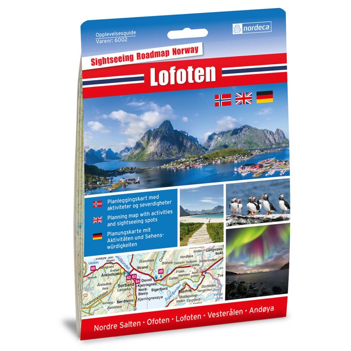
Lofoten 1:250.000. Adventure guide, road map 1:250.000, item no. 6002 issued by Nordeca. Adventure guide Lofoten deals with the routes from Bodø via northern Salten with Rognan and Fauske, Ofoten with Narvik, Vesterålen with Andøya and Lofoten all the way down to Å with detours along the road. The Lofoten archipelago in the Norwegian Sea about 300 km within the Arctic Circle is one of the most beautiful places on Earth. Due to the warm Gulf Stream, it has a coastal climate with mild winters and rather cold summers. The archipelago is known for summer midnight sun, northern lights in autumn and winter. It offers amazing landscape of sky, majestic sharp mountains, deep fjords incredible light. Lofoten is a place of inspiration for artists for centuries. Every winter a lots of Norwegian Arctic cod swim down from the Barents Sea to Lofoten to spawn. The islands have for more than 1,000 years been the centre of great cod fisheries. Thousands of people come to Lofoten to experience fishing adventure. The islands offer beautiful climbing areas, spectacular panorama, coastal trails and beaches. Archipelago is one of the best places in the world for cold-water surfing. The islands attract about million tourists a year. You are never bored there. You can always go skiing, kayaking, climbing, sailing, hiking, walking or enjoy the views. These place names located within the map: Nordre Salten, Ofoten, Lofoten, Vesterålen, Andøya. Nordeca (formerly Ugland IT Group) is a leading provider of geographic information services and geographical data in Norway. The company creates and distributes leisure maps, topographic maps, digital maps. It distributes the data of the Norwegian Mapping and Cadastre Authority (Statens Kartverket), and also products of the Swedish Mapping Authority (Lantmäteriet). With 20 years experience, Nordeca is Scandinavia's largest producer and publisher of maps to the Norwegian market. Nordeca collaborates with a number of major organizations such as the Den Norske Turistforening (Norwegian Trekking Association), Visit Norway, the Public Roads Administration (Vegvesenet), and Rescue Society - Redningsselskapet (RS). The adventure guide, with great pictures from popular tourist destinations, has a lot of useful information for those visiting Norway for the first time. All Opplevelsesguider are available in two versions: first with a large detailed map and tourist guide on the reverse, suitable for planning, and the second one in a more car-friendly format with accompanying booklet. The content and high degree of detail are the same in both versions. You can find all petrol stations, LPG stations and universal charging stations for electric vehicles, ferry crossings, railway lines, a variety of natural and cultural attractions, rest stops, natural scenery and tourist attractions, tourist cabins, National Tourist Routes. You can see plenty of names of mountain ranges, rivers, sea bays, lakes, valleys and fjords. Topography is presented by altitude colouring. All adventure guides are available in three languages - Norwegian, English and German. On the reverse 120 attractions and activities are numerically listed and illustrated with pictures. 2016 update.
| Wydawca | Nordeca |
|---|---|
| Kategoria | Składane |
| Kolejność | 1.01091613919913 |
| Brak prawa zwrotu | Nie |
| Czy są czasy przejść? | Nie |
| Czy są szlaki biegówek? | Nie |
| Czy są szlaki turystyczne? | Nie |
| Skala główna | 250000 |
| Block send with Locker | Nie |