Ireland Kerry touring map
55,90 zł
Brak w magazynie
SKU
PFX0A101
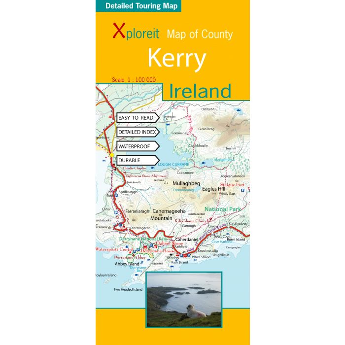
The Xploreit Map of County Kerry includes all of the ‘Kingdom’ of Kerry along with parts of counties Clare, Limerick and a large part of County Cork. Famous tourist destinations such as Killarney National Park, the Dingle Peninsula, the Skellig Islands (a UNESCO listed World Heritage Site), Derrynane House and the ‘Ring of Kerry’ scenic route are all shown on one double-sided map sheet. It illustrates a magical landscape of mountains, lakes, woodlands, rivers and streams bordered by a rugged atlantic coastline which is the longest of any county in Ireland. Golf courses, angling locations, beaches for swimming and surfing, historic sites, tourist centres and a host of other points of interest are clearly identified making this map an invaluable tool for both visitors and locals alike. Several scenic drives, cycle routes and waymarked walks are shown. The scale of the Kerry map is 1:100,000.
It has been possible to include all the national waymarked ways in Kerry and many of the routes in Cork.
All the Kerry cycling routes are shown and many of the routes in Cork are also included.
| Wydawca | Xploreit Maps |
|---|---|
| Kategoria | Składane |
| Kolejność | 1.01126042765555 |
| Brak prawa zwrotu | Nie |
| Czy są czasy przejść? | Nie |
| Czy są szlaki biegówek? | Nie |
| Czy są szlaki turystyczne? | Nie |
| Skala główna | 100000 |
| Block send with Locker | Nie |